 Real estate
Coastal perspective
The coast is part of the story.
Show a property in context: shoreline, water access, surrounding streets, and the landscape that makes it special.
NORTHWEST FLORIDA · AERIAL SERVICES
From coastlines to canopies. Photography, thermal inspections, recovery inquiries, and on-site coordination—with an enterprise drone built for more.
A CLOSER LOOK / 12 WAYS TO SEE MORE
Explore the views, insights, and capabilities we can bring to your next project.


01 / 12 · Coastal perspective
Illustrative stock and reference imagery. Your project deliverables are captured and prepared specifically for your site.
THE RIGHT PERSPECTIVE / THE RIGHT PURPOSE
Photography, useful observations, and a clearer picture of your property. Choose a service to start your flight request.

Property · real estate · brands
Give your listing, property, or business a compelling perspective, with professionally edited aerial stills.
Roofs · buildings · equipment
Review surface-temperature patterns alongside visual imagery to guide a more focused follow-up inspection.

Thermal search support
Request a feasibility review for thermal recovery assistance, subject to wildlife rules and landowner permission.

Land · construction · property
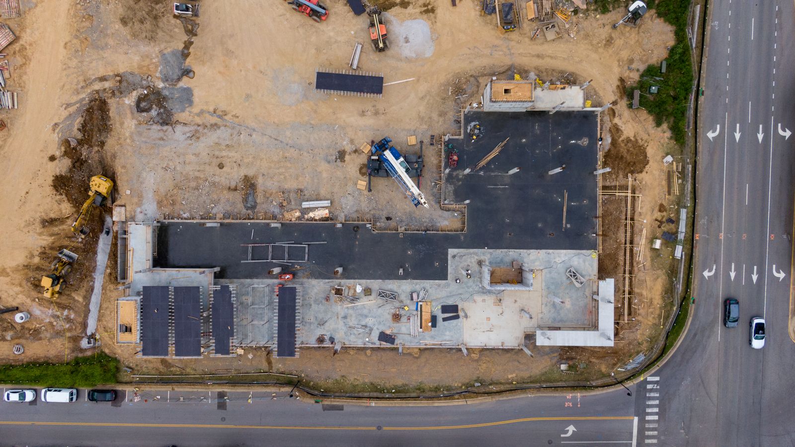
Keep a consistent visual record of your property, construction progress, and owner-authorized site conditions.

Loudspeaker · lights · coordination
Support your ground team with aerial observations, planned announcements, and targeted illumination.

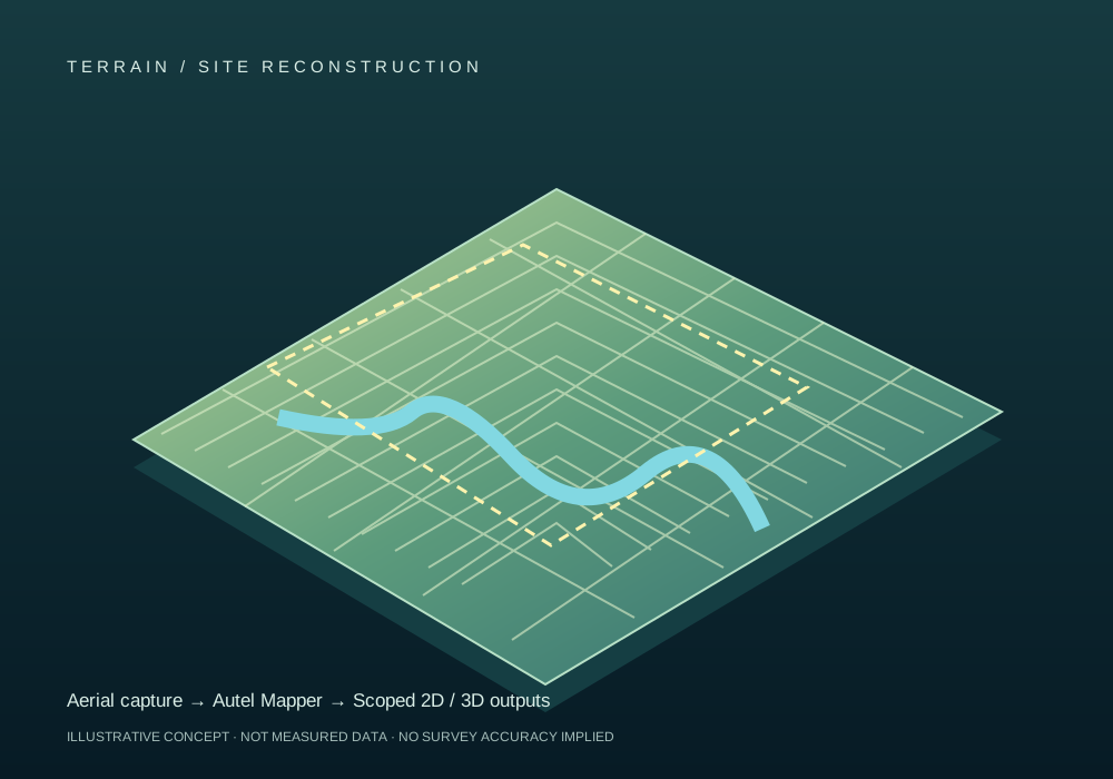
Autel Mapper · 2D & 3D
Turn planned aerial capture into useful site reconstructions with Autel Mapper.

Livestock · acreage · observation
Support livestock management with aerial observations of animals, pasture distribution, and site access.
Crops · irrigation · field conditions
Compare visual and thermal patterns to prioritize field checks and document changing conditions.

A project as individual as you
Land documentation, commercial imagery, or a project that needs a different approach. Tell us your goal.
Starting estimates, with final scope, travel, access and deliverables confirmed before you commit. No payment is collected with an inquiry.
BEYOND THE VISIBLE / THERMAL INSPECTIONS
Thermal imagery adds surface-temperature context to an ordinary inspection. A useful report connects what we see, what it could mean, and what should be checked next.
Find unusual temperature patterns so a qualified trade can focus its follow-up inspection.
Capture roofs and exterior features from a planned aerial vantage point, without walking every surface.
Keep visual and thermal records for before-and-after comparisons under comparable conditions.
Colors represent the selected palette and scale. They are not a pass/fail rating. This example is not calibrated for your property.
SELECT A NUMBER ON THE IMAGE
The upper band has a different thermal appearance from the wall below. In a real inspection, we compare materials, sun exposure, and weather before interpreting that contrast.
Paired visual and thermal images, marked observation locations, capture date and conditions, measurement settings where available, limitations, and recommended follow-up.
Patterns that may warrant checks for insulation differences, air leakage, or moisture-related behavior. Thermal imagery alone does not confirm a leak or hidden moisture.
Identify apparent temperature differences across accessible panels or equipment for specialist review. Loading, reflections, and viewing angle affect interpretation.
Look for thermal contrast from visible people or animals. Vegetation, weather, distance, and obstructions affect detection; thermal does not see through walls or dense cover.
OUR AIRCRAFT / CAPABILITIES THAT WORK TOGETHER
Our Autel enterprise drone brings visual imaging, thermal sensing, positioning, and mission accessories into one flexible platform. We match the setup to your site and the information you need.
AUTEL EVO MAX ENTERPRISE PLATFORM
Capture the scene, reveal temperature patterns, build a site model, or help a ground team see and communicate more clearly.
Explore the capabilities in action ↗Real-time kinematic positioning uses correction data to refine the aircraft’s position. Mapping accuracy also depends on control points, capture quality, and processing; RTK alone is not a certified survey.
Planned overlapping imagery processed in Autel Mapper for scoped 2D and 3D reconstructions of acreage, property, and construction sites.
Use temperature contrast to support exterior inspections and searches, with palettes and measurement tools chosen for the mission.
Targeted illumination and approved voice announcements help coordinate people on the ground during planned site and event operations.
Visual and thermal observations can assist an authorized search team. Mission acceptance depends on conditions and coordination; this is not emergency dispatch. For emergencies, call 911.
Owner-authorized property observation, event situational awareness, and recurring site documentation, with an agreed area, purpose, and privacy boundaries.
THERMAL VIEWS & MEASUREMENT
Palettes change how temperature differences appear; they do not create additional sensing capabilities.
Grayscale views make warmer objects brighter or darker to help separate a subject from its surroundings.
Color palettes help distinguish relative temperature bands and communicate patterns in a report.
Spot and area readings provide temperature estimates when supported and configured for the surface and conditions.
Use a normal photograph alongside the thermogram to locate an observation and understand the surrounding materials.
Available modes depend on the fitted camera and software. RTK correction access, operating permissions, capture plan, deliverables, and accuracy requirements are confirmed for each mission. No unrestricted night, crowd, or beyond-visual-line-of-sight operation is implied.
GULF COAST REAL ESTATE · ILLUSTRATIVE03 / REAL ESTATE, SEEN COMPLETELY
For agents, vacation-rental hosts, property owners, and developers. Combine the imagery that sells the setting with the documentation that helps you plan.
Rooflines, outdoor spaces, pools, and hero angles for listings and property marketing.
Show the coast, nearby amenities, access roads, and the setting around a property.
Aerial overviews and scoped Autel Mapper reconstructions for land and planning discussions.
Repeat construction photography, visual roof observations, and separately scoped thermal reviews.
Serving Escambia, Santa Rosa, and Okaloosa counties. Illustrative lot annotations are not legal boundaries; certified surveys require a qualified surveyor.
FROM PASTURE TO PLANTED FIELD
Practical aerial support for Northwest Florida farms, ranches and landowners. Clear scope. Useful records. Straightforward starting prices.
LIVESTOCK · CROPS · IRRIGATION · LAND
Locate visible animals, compare pasture use, document field conditions and identify surface-temperature differences for a closer ground inspection.
Explore the pricing guide ↓One accessible property; visual and thermal observation where conditions support it.
Timestamped count estimate, location overview, coverage notes and visibility limitations.
Four or more planned visits to the same property, up to 100 acres per visit.
Repeat observation points, distribution changes and owner-selected areas of interest. Minimum four visits: $700.
Up to 100 acres; additional acreage and repeat passes quoted.
Reviewed imagery, observed-count worksheet and reconciliation with your supplied inventory. Unseen animals and uncertain sightings are flagged.
Up to 40 acres; additional accessible acreage estimated at $4 / acre.
Paired visual and thermal observations, temperature-pattern hotspots and a ground-check priority list.
Up to 40 acres; larger sites and repeat surveys quoted.
Document visible water distribution and thermal differences that may merit an irrigation or drainage check.
Up to 25 accessible acres, with final processing scope agreed.
Autel Mapper 2D reconstruction; 3D models, RTK workflow and elevation deliverables priced by requirements.
Planning estimates in USD, not a binding quote. Acreage means the area agreed for coverage, not necessarily the entire parcel. Travel, separated pastures, dense cover, terrain, animal movement, weather and reporting can change the scope. No surprise add-ons: approve the final quote first.
Canopy-temperature differences may help flag water stress or uneven irrigation. Visual imagery can document standing water, bare patches, storm damage and pasture distribution. Repeat visits help compare changes under similar conditions.
Animals can overlap, move or disappear behind trees. We report observed counts, coverage and uncertainty. Audit support helps reconcile your records; it is not a certified inventory, veterinary assessment or guarantee that every animal was seen.
Thermal reads surface-temperature patterns; it does not diagnose crop disease, measure soil nutrients or see through canopy. NDVI and other multispectral indices require suitable additional sensors. This guide covers imaging and observation, not spraying.
BUILT BY MULTINEX. FOCUSED ON THE PANHANDLE.
At Multinex, we build AI systems that help people turn complex information into useful decisions. CoastLight Drone Services brings that same curiosity and engineering mindset into the air.
We saw an opportunity to apply our experience with AI technology to drone services—exclusively in the Florida Panhandle. From coastal real estate to inland farms, our focus is simple: capture the right information, make it understandable, and help you decide what to do next.
Our initial service area covers Escambia, Santa Rosa and Okaloosa counties. Every project starts with your goal and a carefully scoped flight and reporting plan.
Meet Multinex ↗ROOTED IN NORTHWEST FLORIDA
Serving Escambia, Santa Rosa and Okaloosa counties: Pensacola, Pensacola Beach, Cantonment, Gulf Breeze, Milton, Pace, Navarre, Fort Walton Beach, Destin and Crestview. From waterfront listings to inland farms, each request starts with a location, airspace and access review.
TAKE THE NEXT STEP
Tell us what you need to see, measure or document. We’ll help define the flight, deliverables and price.
Choose a service and tell us about your location, timing and goals.
We review access, conditions and the scope before confirming a quote.
Approve the plan and payment arrangements before a flight is booked.
A few details now. A clear scope and quote before you commit.
BEFORE WE FLY
No. Dates are requests until we confirm availability, location, weather, and the flight plan. Your quote will include delivery timing and any rescheduling terms.
Online payment is being connected. Please request your service first; payment arrangements will be included with your confirmed quote. Do not email card numbers or banking details.
Every mission requires a location and operating review. Event support is subject to applicable FAA requirements and venue approval. A booking does not authorize flight over crowds or restricted airspace.
Thermal imaging shows surface heat patterns; it does not see through walls or guarantee detection. Deer recovery requests require a review of applicable wildlife rules and landowner permission. We do not offer live-game pursuit or emergency dispatch. For an immediate threat to life, call 911.
The booking form prepares an email on your device. We use information you send to respond to and coordinate your request. No card details are collected here. Contact drones@multinex.ai with privacy or deletion requests. Stock and reference images load from Unsplash, Pexels, and Wikimedia, which receive ordinary web request data.
